

| 2011-06-19 13:09:56 |
Weather Station Vantage Pro2 is installed at Aragats
The Davis Instruments Vantage Pro 2 weather station is
installed on Mt. Aragats research station at 3200m altitude. It measures and
sends to the CRD database (and to Davis Instruments site) values of the
barometric pressure, temperature, humidity, rainfall, wind speed and direction,
solar and ultraviolet radiation. Also the
station calculates and stores highs and lows of virtually all weather variables
for the past 24 days, months, or years.
Meteorological information is necessary to correlate weather conditions
with Thunderstorm Ground Enhancements (TGEs).
It will be helpful to schedule the winter shift changes to CRD's high
altitude research center and to provide key meteorological information to tourists
visiting Mt. Aragats.
The WeatherLink Network of Davis Instruments is a collection of websites containing customer weather information that is stored on a server owned by Davis Instruments. Being part of the WeatherLink Network and having a site on WeatherLink.com means that we will be a part of a community of weather enthusiasts who use the WeatherLink Network to view their own weather data and to share that weather data with friends and people across the world quickly and easily. Below is the screenshot from Davis WeatherLink site for the region near Armenia. As it can be seen, the Mt. Aragats weather station is the only meteorological information source within a radius of of 1000 km.
The WeatherLink Network of Davis Instruments is a collection of websites containing customer weather information that is stored on a server owned by Davis Instruments. Being part of the WeatherLink Network and having a site on WeatherLink.com means that we will be a part of a community of weather enthusiasts who use the WeatherLink Network to view their own weather data and to share that weather data with friends and people across the world quickly and easily. Below is the screenshot from Davis WeatherLink site for the region near Armenia. As it can be seen, the Mt. Aragats weather station is the only meteorological information source within a radius of of 1000 km.
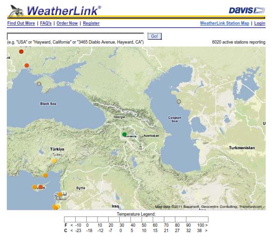
Figure 1. The dots represent Davis weather stations. The green dot means that the temperature on Mt. Aragats is low. http://www.weatherlink.com/map.php